| Creative Software | Education Software | Articles | Tutorials |
|
||||
|
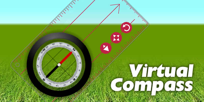
Virtual Compass:
|
| Equipment Needed Download Portable Version |
Recommended: Computer with SmartBoard/Interactive White Board and projector, 40MB storage space for software on hard drive, network drive or USB stick. Minimum required: Computer with monitor visible to class/group, 40MB storage space for software on hard drive, network drive or USB stick. |
|---|---|
| Equipment Needed Online Version |
Recommended: Computer with SmartBoard/Interactive White Board, Internet Browser with Flash Plug in, Internet Access, and projector. Minimum required: Computer with monitor visible to class/group, Internet Browser with Flash Plug in, Internet Access. |
| Materials Needed | None. If you don't have enough compasses to go round, students can always use Virtual Compass on the classroom computers. |
| Time Needed | Teacher discretion. |
| Space Needed | Teacher discretion. |
NEW! Download 1.0 Portable - 18MB
| Download Software | Download desktop version 1.0 for Windows > The new windows download version allows you to import map images from your own computer quickly and easily. Supported map image file formats are JPEG, GIF and PNG. The download version does not need to be installed so you can use it straight away without needing to bother IT Technicians. The download version is portable, and can run directly from a USB memory stick. Just unzip the folder, open, and run. |
|---|---|
| Play Online | An older online version of the program is available here: Allow a couple of minutes for loading. |
| Additional Resources | Coming Soon |
The compass has 5 controls to help you in your demonstrations:
Rotate Baseplate

This button is found on the compass Baseplate.
Click and drag this button to rotate the compass base plate on the screen.
Move Compass

This button is found on the compass Baseplate.
Click and drag this button to move the compass on the screen
Scale Compass

This button is found on the compass Baseplate.
Click and drag this button horizontally to change the size of the compass on the screen.
Drag left to shrink the compass on the screen, drag right to enlarge the compass on the screen.
Rotate Dial (Bezel)
Click and drag any part of the Dial (or Bezel) to rotate it on the Baseplate.
Reset Compass

This button is found on the control bar at the bottom of the screen.
Click this button to restore the compass to it's original position and size on the screen.
Import Map
You can demonstrate using the compass with any map image available on your computer in JPEG, GIF or PNG format.
Either press the "Import Map" button:

Or in the menu choose FILE > IMPORT MAP.
Browse your computer and select a map image in either JPEG, GIF or PNG format. The image will load into the Virtual Compass.
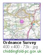
Find a Map Image
You can demonstrate using the compass with any map image available on the internet provided it is in JPEG format. A Google image search for "os maps" might be a good place to look.
Once you have found a suitable map image in JPEG format, click the image thumbnail to go to the full size version.
Copy the Map Image Link
When the next page comes up, right click the "See full size image" link and choose Copy link location if you are using Firefox, or Copy shortcut if you are using Internet Explorer.

Load the Map Image into Virtual Compass
Return to the Virtual Compass software and paste the link into the "ENTER MAP IMAGE" box. Then press the green download map button.

Depending on how large the image is, and how slow the server or internet connection, it may take a short while for the map to load.
If you have been waiting for more than about a minute, it may be that the image is no longer available online, or that it is not a JPEG, and you should try another image (it is a good idea to make sure the images you need are available in advance of the lesson). Future versions of this software will also allow you to select images from your own computer.
Once the map image is loaded it will appear on the screen like this.
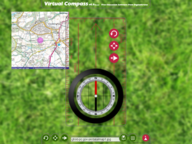
Once the map image is loaded there are 4 controls to help you in your demonstrations:
Rotate Map

This button is found on the controls panel at the bottom of the screen.
Click and drag this button horizontally to rotate the map on the screen.
Drag left to rotate anti-clockwise (or counter-clockwise), drag right to rotate clockwise.
Move Map

You can move the map by simply clicking and dragging the map itself.
You can also use this button found on the controls panel at the bottom of the screen.
Click and drag this button to move the map on the screen
Scale Map

This button is found on the controls panel at the bottom of the screen.
Click and drag this button horizontally to change the size of the map on the screen.
Drag left to shrink the map on the screen, drag right to enlarge the map on the screen.
Reset Map

This button is found on the control bar at the bottom of the screen.
Click this button to restore the map to it's original position and size on the screen as it was when it was first loaded.
In the "old" days we would have copied a map onto acetate and used an OHP to project the map and compass silhouette onto the screen. But these days OHPs are hard to come by (where I work anyway) and so an up to date alternative was needed. I love to develop interactive software in my own time, and this project has been one I really enjoyed.
Happy navigating.
Usage TipsGroup Teaching Individual Working Range of Uses |